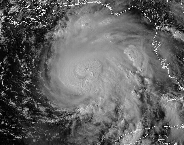
Most dangerous storm surge to hit Pinellas after hurricane force winds have passed, Officials warn8/29/2023 With some of the highest tides of the month expected to happen throughout the day Wednesday, Pinellas County Emergency Management is warning that storm surge flooding could be worse in many low-lying areas and could continue after winds from Hurricane Idalia have subsided, a release states. The National Hurricane Center is projecting a storm surge of 4 to 7 feet in Pinellas County, which prompted the Zone A evacuation that began on Monday evening. Due to the timing of the storm interacting with varying times of high tides, some areas could see waves bringing floodwaters 1 to 2 feet higher than that. In anticipation of widespread coastal flooding, the Pinellas County Sheriff's Office, Florida National Guard, and all municipal fire and police departments have reviewed the positioning and usage of water rescue teams prior to the storm making landfall. The storm surge impacts are expected to be worst during high tide along the Gulf Coast from Tarpon Springs to Treasure Island. Zone A communities along Tampa Bay are also expected to experience storm surge and king tide impacts, but they may be less severe. Pinellas County remains under a Zone A evacuation order. All mobile home residents are also ordered to evacuate. Pinellas County is now under a tornado watch through August 30 at 6 am. Wide-spread power outage is expected based on projected wind speeds of 30 to 70 mph. In the event of an outage, you can report it to Duke Energy by texting OUT to 57801, by phone at (800)-228-8485, or online at www.duke-energy.com/outages. The City of Clearwater also asks that you avoid going on to the barrier islands until it's been announced that conditions are safe. To look up possible storm surge flooding projections from the National Hurricane Center, click here.
0 Comments
Your comment will be posted after it is approved.
Leave a Reply. |
CATEGORIES |
|
|
Vertical Divider
|
Can't get enough?Uncover more of Florida through our channels below!
|
© COPYRIGHT 2015. ALL RIGHTS RESERVED.


 RSS Feed